Where you will find ABS signals
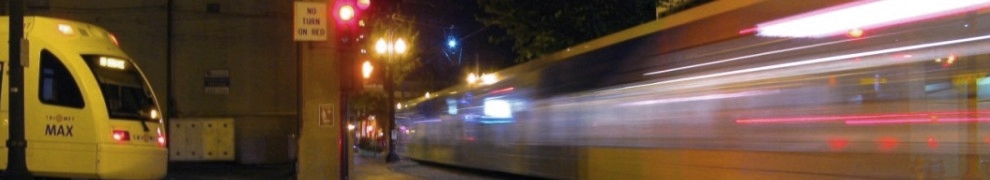
I’ve mentioned “ABS territory” in the last few posts – most of the alignment is in that category. In ABS territory, trains have a dedicated right of way and intersections are protected by crossing gates.
You’ll see signs on the alignment saying “BEGIN AUTOBLOCK” which designate entering ABS territory from pre-empt territory, and “END AUTOBLOCK” which designate leaving ABS territory and entering pre-empt territory. One example –
 E 102nd Ave looking westbound – beginning of ABS territory
which extends through…
 Just east of Lloyd Center – end of that particular segment of ABS territory which extends along the Banfield
ABS territory includes:
 Areas in green are ABS territory
Note: the above map isn’t perfect – there are some platforms on the border of ABS territory that have pre-empt signals in one direction & ABS in the other – and then a platform such as Lloyd Center isn’t in ABS territory, but leaving Lloyd Center eastbound there is both a pre-empt and an ABS signal – Goose Hollow is also similar, except there is both an ABS and a pre-empt going westbound. But the map should give you an idea at least. From west to east:
Westside Blue Line – 12th & Washington westbound through the tunnel is ABS territory. Goose Hollow westbound also is ABS.
On the Yellow Line -the Vanport Bridge after Kenton/Denver and points north
Red, Green, and Blue – from points east of Lloyd Center through the airport (Red), Clackamas Town Center (Green), and Gateway (Blue)
And for the Blue Line – Ruby Junction and points east.
Signal location
All ABS signals and combination signals (more on that in a later entry in this series!) are numbered to make them easy to identify and for operators to use when reporting their location to Rail Control.
On the Blue, Red, and Yellow lines, signal numbers correspond to their distance from the 11th Ave terminus downtown.
And point of trivia (not like this whole blog isn’t trivia, but whatever) – most eastbound main signal numbers end in 4, most westbound main signals end in 6.
Blue Line – east side
 Signal 138, Gresham City Hall westbound – roughly 13.8 miles from 11th Ave
The signals east of the 11th Ave terminus on the Blue Line alignment have no designating letter, but the signal numbers increase as you head east from 11th Ave, and the numbers give you an estimate of their mileage from the 11th Ave terminus up to Signal 160, which is used by trains leaving the tail track into the Cleveland Avenue platform.
Blue Line – west side
 Signal W1056 – Elmonica westbound, just over 10 and a half miles from 11th Ave
The numbers of signals west of 11th Ave terminus all begin with W and go up to W1778, which is one of the signals to leave Hatfield Government Center, nearly 18 miles from 11th Avenue.
Yellow Line
 Signal N60, located at the Expo Center
Signals along the Yellow Line alignment from Interstate Rose Quarter through Expo Center begin with N2A and N2B, and go up to N62 at the Expo Center, a little over 6 miles from the 11th Ave terminus (I know these maps aren’t perfect, they’re just to give an idea of location and distance).
Signal numbers on the Red and Green Lines correspond to their distance from Gateway
Red Line
 Signal A550 – Airport Terminus
On the Red Line airport alignment, the signals begin with A – the lowest number is A88 (which is visible to trains heading into Gateway) and they go up to A552 which is one of the two platforms at the PDX Airport Terminus. These numbers don’t relate to the distance from 11th Ave terminus – they correspond to the distance from Gateway, which is about 5 and a half miles away.
Green Line
 Signal C94 – SE Main Street southbound
Signals along the Green Line alignment to Clackamas Town Center begin with C. These go from signal C14 near Gateway where the Green Line diverges south up through signal C630 which is the tail track signal at Clackamas. Again, like with the Red Line Airport extension, these numbers correspond to the distance from Gateway rather than the distance to 11th Ave.
Downtown Mall
 Signal M176A – Jackson turnaround
The ABS and combination signals on the downtown mall begin with M, beginning with the M176 signals in the Jackson turnaround and going up to the ABS & combination signals near Union Station and on the Steel Bridge (M16 is the lowest signal number at the Steel Bridge).
That pretty much covers ABS signals I think… up next, pre-empts!


Pingback: Tweets that mention Signal Series – ABS Part 3 « MAX FAQs -- Topsy.com
Maybe I’m just looking at this incorrectly, but it looks like the ATS magnet in the first picture is behind the call loop. I’m gonna take a guess and say that the call loop past the ATS magnet is a backup in case the operator passes the magnet, gets stopped, and after bypassing can still select without reversing on the mainline. Am I way off? (I think I’ve read something about operators needing to switch cabs, pull back, then return to their front cab to handle that, too.)
You’re correct that it’s behind the call loop, but it’s not a backup. If you stop a train with the transponder over the call loop, you won’t get trip (that’s how it’s designed to work). However, if you go too far forward while the signal is still red, then the magnet will be active and your train will be stopped. You need to place a call while over the call loop to get a permissive signal and to have the ATS not be active.
And yes, sometimes it’s necessary to pull back a train. That could happen if an operator goes too far over the call loop (with or without tripping) – if you go too far but haven’t tripped, you call Control & let them know you overshot it. Sometimes they can call the signal for you, other times it will be necessary to switch cabs and pull back. That can also happen at platforms where there is no ATS magnet – for example if I’m at Jeld Wen downtown and I go too far, it’s not going to trip anything but I’ll need to pull the train back to get the lead cab back over the call loop to proceed. But if you do trip the signal, then you’ll have to pull back and recall (where applicable – some signals do not have call loops and are just there to mark train occupancy ahead of you so there isn’t anything to call, if you run a red there you can’t do anything to make it yellow or green, you have to just wait until your leader is far enough ahead for that to happen.)
Now I see! Thanks! And, that brings up my next question… What does control see/have remote control of in terms of ABS territory? Is there a “map” of signals and trains they can see so they get a better picture of traffic on the alignment?
When it’s working properly, yes. I don’t know if you’re one of the people who follows the scanner, sometimes you’ll hear that the overview isn’t working so Control can’t see where the trains are then – this is why it’s really important for rail operators to give their train number, direction, & location when using the radio.